Hurricane Harvey Causing Concern for Ground Freight Operations
Even being hundreds of miles away from the center of the storm, Hurricane Harvey wind gusts will be capable of tipping a Less than Truckload, LTL trailer.
While it is no surprise that a hurricane can cause hazardous weather conditions for the trucking industry, it is always important to be vigilant, check reliable sources of weather information, and heed the postings of local, state, and federal emergency management.
Here are a few tips to keep in mind if your shipping schedule takes you into or near the impacted areas of Hurricane Harvey:
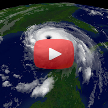
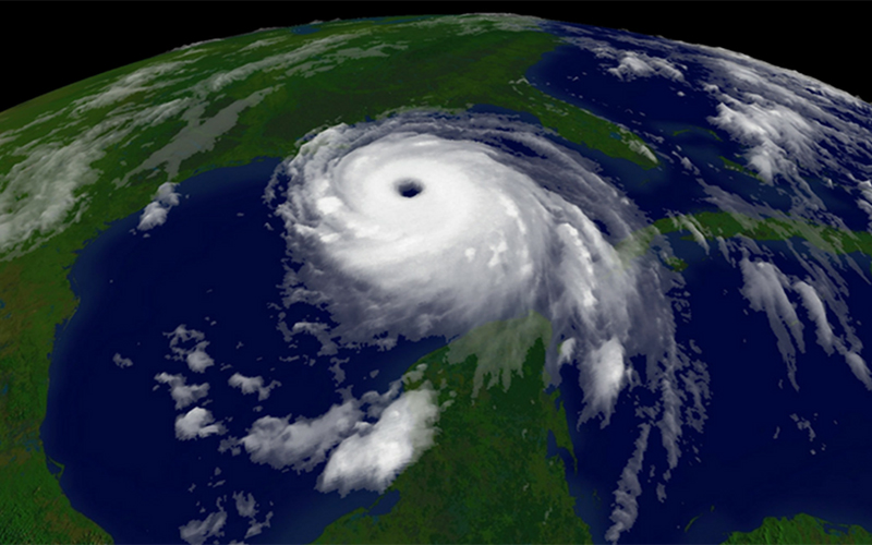
A hurricane is much more than a storm that impacts the landfall location.
The media pays great attention to the point of landfall; however, serious impacts of Harvey will be felt more than 200 miles from the eye of the storm.
The most notable impacts to be aware and cautious of are:
- High winds and wind gusts: At the time of this writing, Harvey is expected to be packing sustained winds of 115 mph, with gusts up to 140 mph when it makes landfall. Even hundreds of miles away from the center of the storm, wind gusts capable of tipping a LTL trailer will be present. Shelter your trailer against a building, or park alongside other full trailers if you are close enough to the impacts of this storm.
- Flooding: Even as this hurricane is downgraded to a tropical storm or even a tropical depression, the amount of rainfall expected as the storm lingers along the coastline is staggering. It takes only 12” of moving water to impact and even sweep away a vehicle – and run-off from less than 1” of rain can collect, pool and stream to create that. For Harvey, nearly 30” of rain is expected to impact a large portion of the Gulf Coast. Do NOT drive through standing or running water on any roadway. Flooding issues from Harvey are expected to persist for several days following the storm’s landfall.
- Severe weather: Severe thunderstorm outbreaks often occur in the outer bands of a storm. While they produce more of the same conditions (high winds and heavy rains), their impacts are concentrated and can even produce tornadic circulation. Like other impacts, severe weather can be expected even a few hundred miles from the storm’s center.
The best advice for all is to simply avoid the broadly impacted area of this storm leading up to and for the days following landfall. If you are unable to avoid the area, obey postings, road closures, and recommendations from emergency management officials in the area.
Source: The Weather Company
Related Article: Helping Procurement Professionals Build Resilience in Their Own Supply Chains